The Maurice River Reaches Project
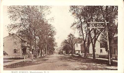
Mauricetown
Reach #33
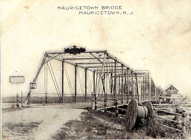
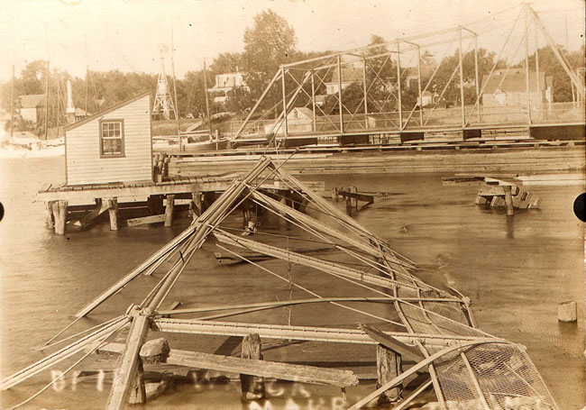
For nearly a century, "the key" to this little village was attached to a bridge - the iron span of the "Old Mauricetown Bridge," to be exact. Since 1888, the old pivot drawbridge was manned by bridge tenders and gaggles of youngsters, who would turn the key to swivel the iron span, allowing watercraft to pass up and down the Maurice River. (More information on the bridge) A modern bridge, built in 1971, put the last of the bridge tenders, Albert Reeves, out of work. (see photos of bridge wreck)
Ralph DiPalma has a unique connection to that modern bridge. He said that when the new bridge was being planned at Mauricetown, he and his partner Lou Miller received a letter asking how high the mast on the Lindbergh, their oyster boat, was. The Lindbergh's mast measured about 25 feet. At that time, the Lindbergh was the only local vessel with a mast that high, DiPalma said. "And that determined how high the new bridge was going to have to be," he said, with glee.
 An article in the Bridgeton Evening News, dated December 21, 1971, reported that the very first boat to pass under the new bridge was the cruiser Concordia. The captain was Russell M. Burcham.
But the village is more than the sum of its bridges and boats. In its heyday during the height of the oystering era, and for significant periods on either side of those decades, Mauricetown was a thriving community. It was a village of captains and shipbuilders. At the turn of the 19th century, the town was self-sufficient.
 Lifelong resident Irene Reeves Ferguson recounted what she learned about the historic town during the time period when her father, Joseph Reeves, Sr., was growing up there. There were several grocery stores, a cobbler, milliners, carpenters, and a wheelwright. Many of these businesses were right on the properties where these entrepreneurs lived. "Everything was right here," Ferguson said, including the Flagg Hotel, built by one of her ancestors.
According to the 1876 Atlas of Cumberland County, John Peterson and Luke Mattox settled in the area now known as Mauricetown in 1730. In his book, Old Inns and Taverns of West Jersey, author Charles Boyer reported that Peterson opened a tavern there in 1742. Boyer noted that this settlement on the Maurice River had no specific name until the late 1700's. A 1789 reference to the location refers to the place as Luke Mattox Landing. Another reference is found in a handwritten document from 1793. That document, "Agreement for Banking along 'Morris' River" which is archived in the Cumberland County Collection, denotes the name Luke Mattox as one of the survey points for a dike along the western shore of the Maurice River. The location was known as Mattox Landing until 1812.
Within the town are several historic structures. The Ceasar Hoskins cabin was built circa 1714, predating the arrival of Peterson and Mattox. That dwelling and other historic houses from the era still stand and are a point of pride for the tiny community.
In the tiny but significant publication, A History of Mauricetown - A Sea Captains' Village, the authors, John and Diane Smith give their impressions of the historic location. They wrote, "Below Port Elizabeth we find the first high ground, the first fast land, the ferry, Mattox Landing (of the )1780's, the bridge at Mauricetown - all located in the same place."
They also note that "In 1726, there is no historical mention of any other homes in Mauricetown other than that of Caesar Hoskins." They observed that no significant development occurred "until John Peterson settled in Mauricetown." Downe Township records still refer to Mauricetown as Mattox Landing as late as1820.
The authors also mentioned an obscure landmark that may have been better known in the days of the early settlers, a local haunt called Devauls' Island (Devils' Island).(See reach # 34.) The publication cites Supreme Court records from the late 1800's, locating Devaul's Island "on the east side of the Maurice River directly across from Mauricetown in the marshy, swamp area" between the river and what is now the Delsea Drive.
There is one source that could be very revealing if more copies could be located. That would be the community's weekly newspaper, the Maurice River Pilot, which was first published in 1906. One partial copy, dated August 11, 1916, was located at the Mauricetown Historical Society. This issue was in fragile condition, but what was readable provided some revealing anecdotal news.
One article reported an incident involving Joseph Reeves, Sr. and his father Morton Reeves - and their encounter with a hungry shark. Another report described an enormous sea turtle (weighing nearly 100 ponds - and big enough to carry a full sized man) that was "caught" right at the mouth of the Maurice River by Joseph Percy Reeves.
No other copies of this paper or its counterpart, the Reporter, have become available. But there is a copy of a commemorative issue of the Maurice River Pilot in the NJ Room of the Cumberland County Library. This commemorative issue was published in September 1980, on the occasion of Mauricetown's 250th anniversary celebration. It recaptures some the flavor of this salty little sea captains' community and gives readers a glimpse into the past.
 click to navigate the map "up".
 click to navigate the map "down".
 click to navigate the map "left".
 click to navigate the map "right".
 click to "zoom in" for a closer look.
 click to "zoom out" to back away from the map.
 click to get back to the "default" map setting.
 click to learn more about that reach.
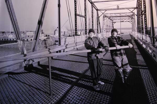