Debra A. Barsotti
Research Journalist
Citizens United to Protect the Maurice River
and Its Tributaries, Inc.
The Maurice River Reaches Project
Haley's Gravel
Reach #14

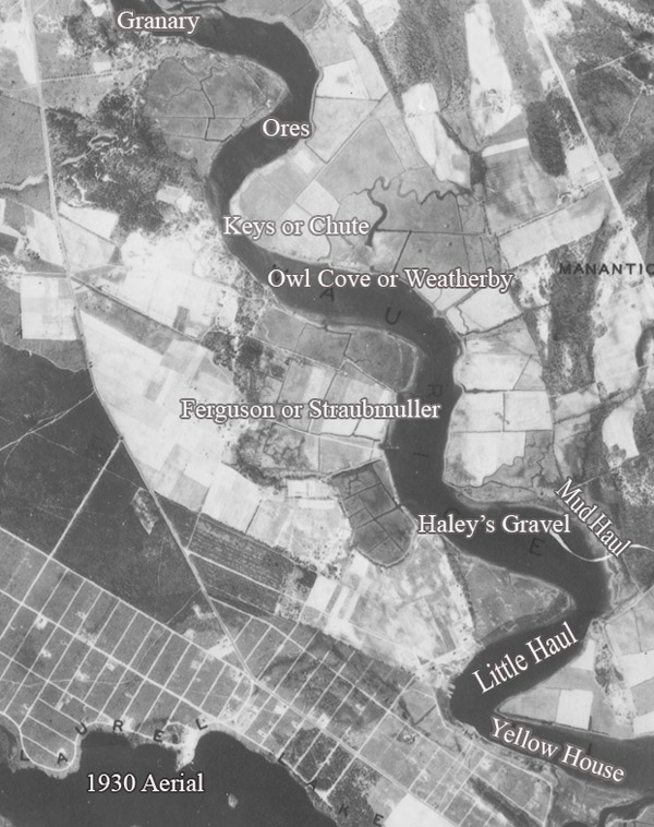
Peter and Jane Galetto live on the reach of the Maurice River that was once known as Haley's Gravel. Some locals refer to the spot as Stony Beach. On the1876 survey map commissioned by the NJ Riparian Commissioners, the western shores of the Maurice River are designated high meadow, upland, and further low meadow. There is a marking, "Little Kiln," at the wharf line of the river between the high meadows and the uplands. This 1876 map shows Jos. C. Tees as the owner of the property along this reach.
Deeds show that George Pettinos was the owner of the land along this stretch of the river for most of the 1900's. Local journalist Jean Jones and her family often started their water-skiing adventures here - on the little beach they knew as Stoney Beach, perhaps named this because there were lots of stones visible at low tide.
Local resident Richard Weatherby confirmed that the name Haley's Gravel was attributed to this river reach. Weatherby, who refers to himself as a "waterman," followed in the wake of his grandfather and father, who made their living from the Maurice River.
Weatherby can locate the reach by a nearby landmark… er, rivermark. He said that the remains of a ship hull are still hung up in the shallows at that section of the river. Weatherby believes that the vessel was the W.E, which was used to haul shipments along the East Coast. Weatherby produced a photo of the W.E. traversing the Maurice River.
Leesburg resident Drew Tomlin also recalled that the ship, the W.E., traveled the Maurice River. He believed that the ship was hauling grain for the Cargill Granary. Tomlin didn't know the fate of the ship nor the name of this reach. 6/06.
 click to navigate the map "up".
 click to navigate the map "down".
 click to navigate the map "left".
 click to navigate the map "right".
 click to "zoom in" for a closer look.
 click to "zoom out" to back away from the map.
 click to get back to the "default" map setting.
 click to learn more about that reach.